OurServices
Integrated Engineering Design, BIM, Reality Capture & Sustainable Solutions
Engineering Services
Comprehensive engineering services including CAD drafting, BIM modeling, 3D laser scanning, and scan-to-BIM conversions.
BIM Modeling & Coordination
End-to-end 3D Building Information Modeling up to LOD 500 across Architectural, Structural, MEP, Infrastructure, 4D Scheduling, 5D Cost Estimation, VR Rendering, and Periodic BIM Audit Reporting.
End-to-end 3D Building Information Modeling up to LOD 500 for commercial, residential, healthcare, and industrial structures.
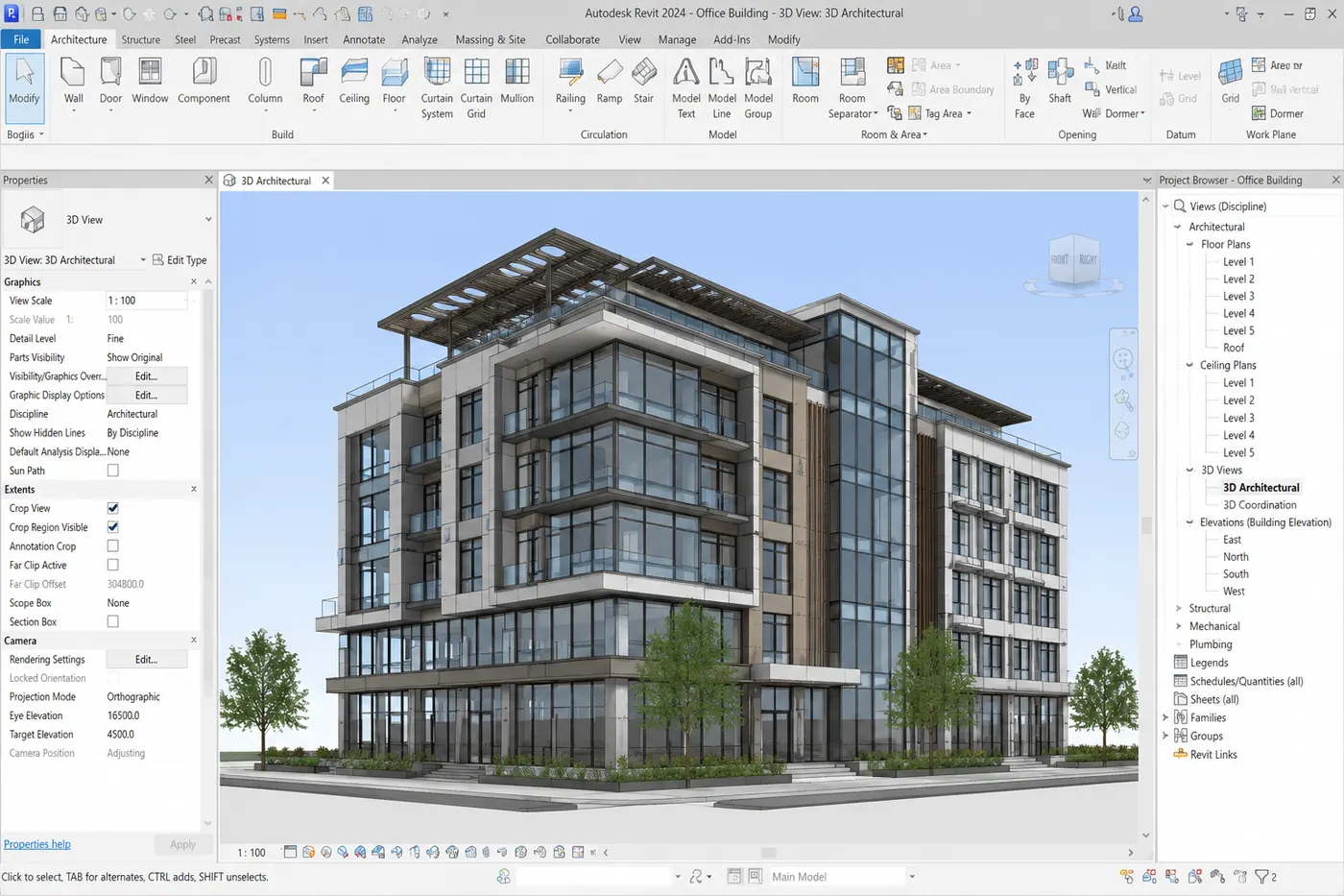
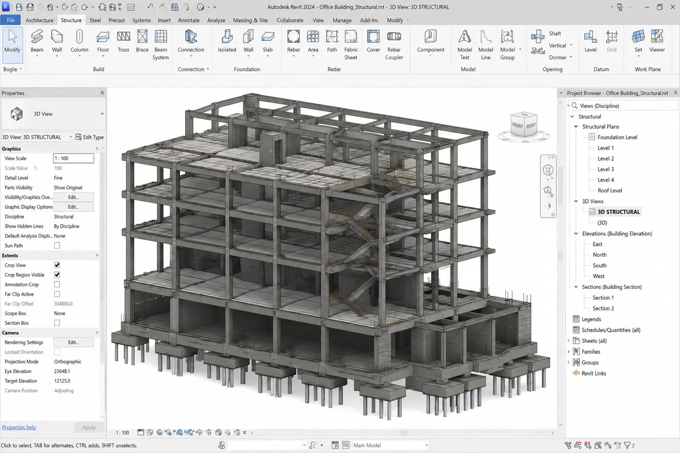
Intelligent 3D parametric architectural BIM modeling, wall envelope assemblies, facade detailing, spatial floor plans, and authority compliance models.
Architectural models are built from intelligent, parametric elements — walls, floors, roofs, doors, windows and façade systems carry real data, not just shapes. Drawings, schedules and area reports come straight from the one model, so they stay consistent as the design develops.
- Parametric model to the required LOD
- Façade and envelope detailing
- Plans, sections and area schedules from the model
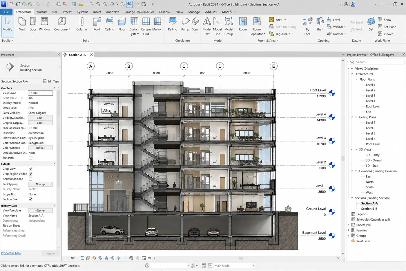
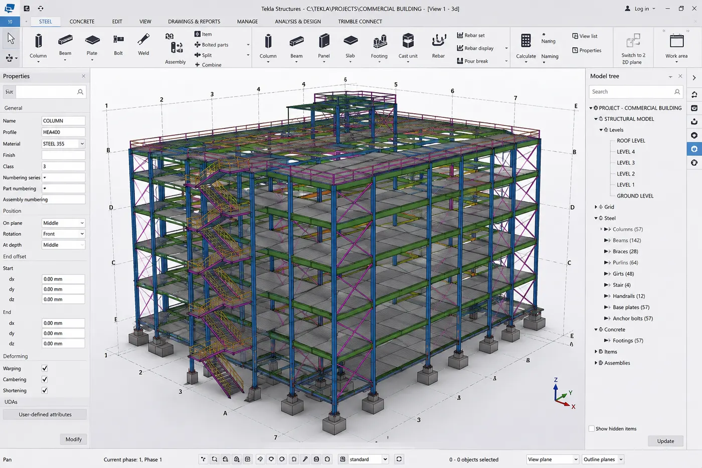
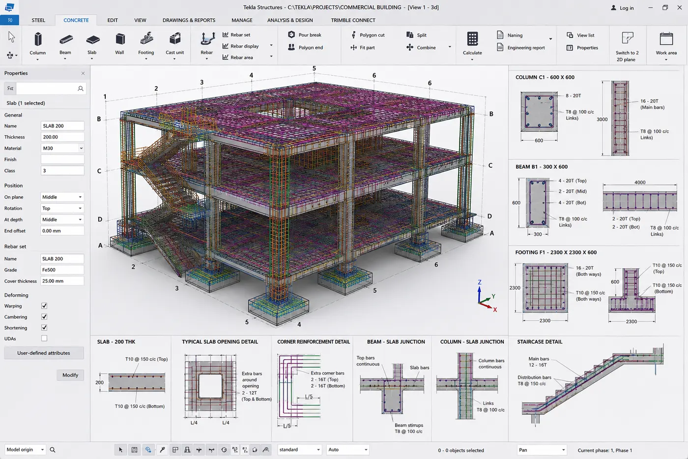
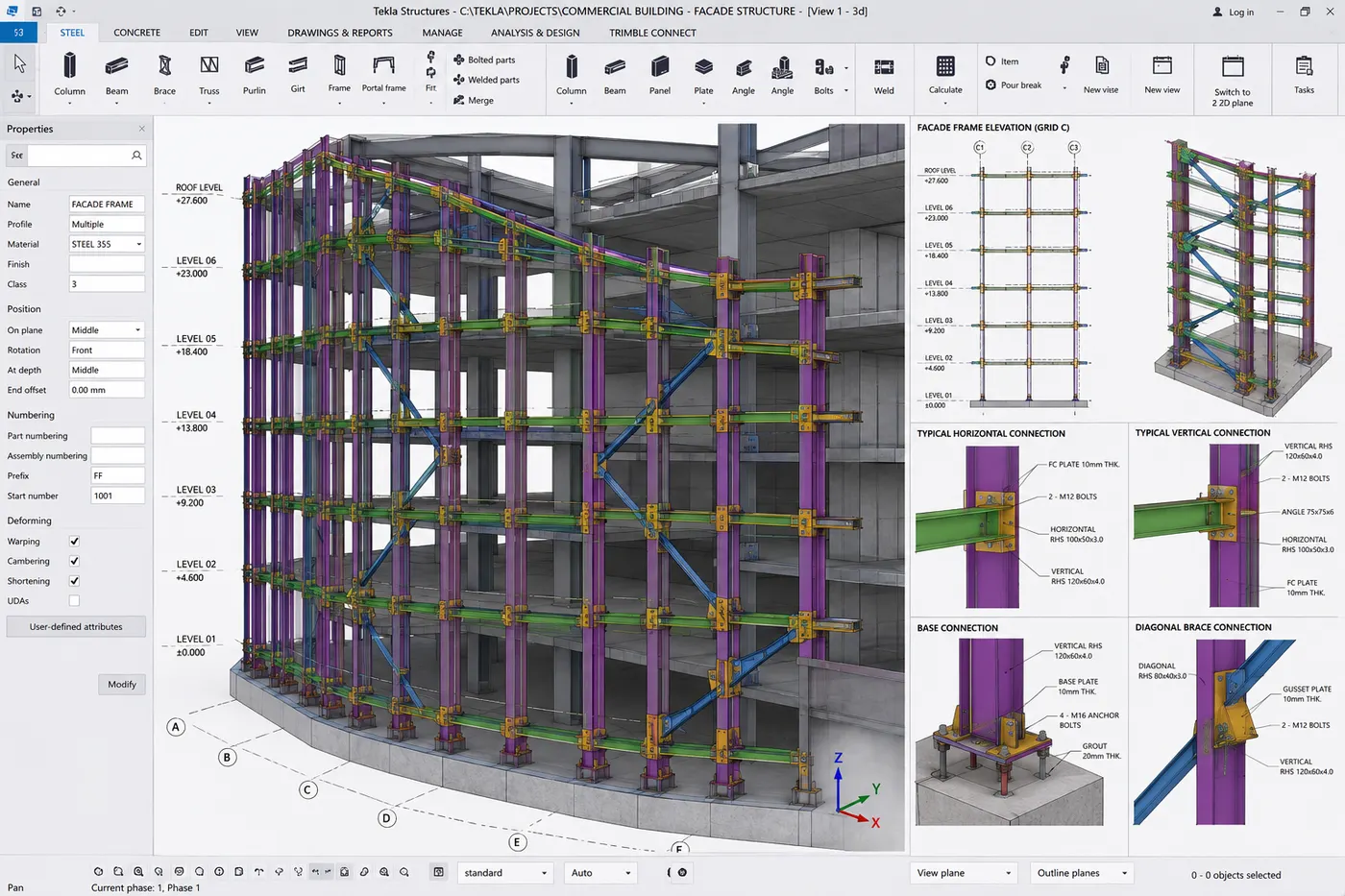
Structural 3D BIM modeling including reinforced concrete framing, post-tensioned slabs, structural steel connections, and foundation rebar detailing.
Structural members are modelled with the sizes, levels and connections needed for coordination and fabrication. Concrete, post-tensioned and steel systems sit together with the architecture and services, so conflicts with openings, ducts and pipes are found before work starts on site.
- RC, PT and steel framing models
- Connection and rebar detailing
- Structure coordinated with MEP
High-LOD interior BIM modeling, ceiling systems, wall finishes, custom millwork, furniture layouts, and spatial interior coordination.
Interior models capture the fit-out in detail — ceilings, partitions, finishes, joinery and furniture. This lets the design intent be reviewed, quantities counted and ceiling-void services coordinated before installation.
- Ceiling, partition and finish models
- Joinery and millwork detailing
- Coordinated ceiling layouts
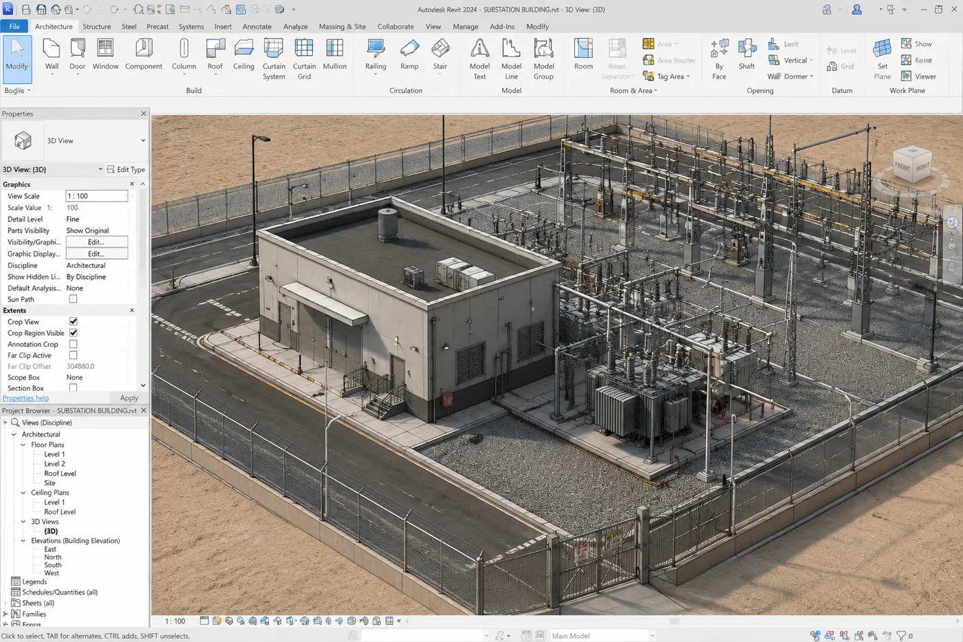
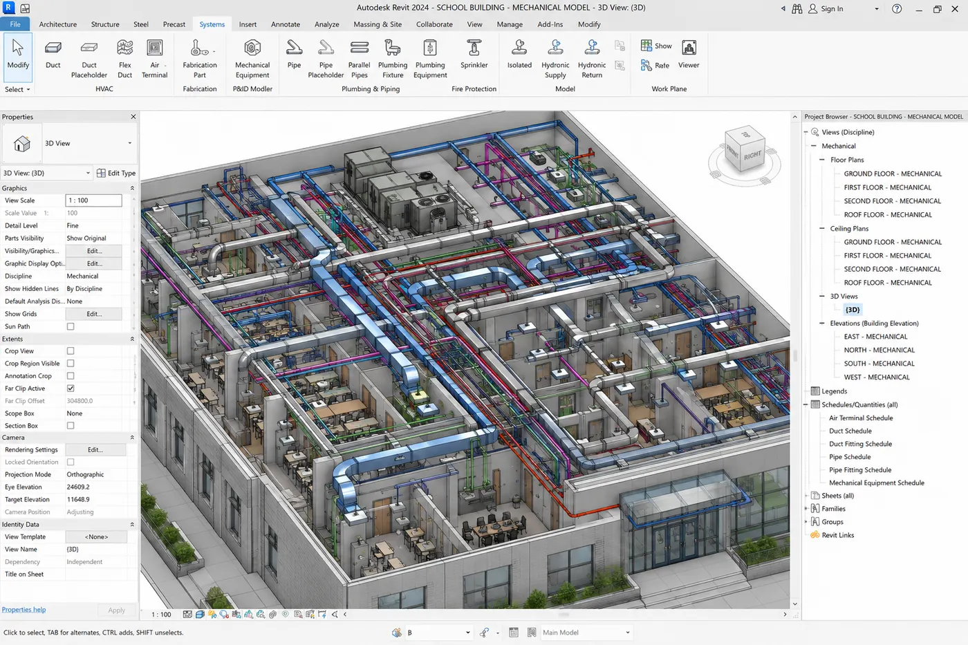
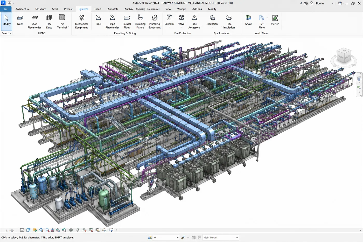
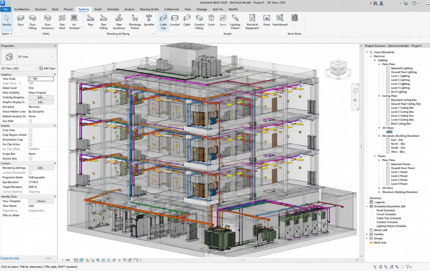
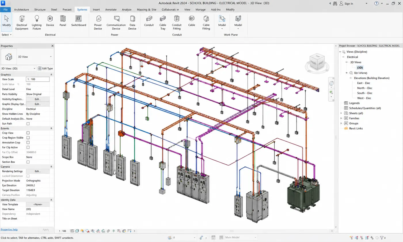
3D MEP BIM modeling covering HVAC ductwork, chilled water piping, electrical containment pathways, plumbing networks, and clash-free plant room layouts.
HVAC, chilled water, plumbing, drainage, fire and electrical systems are modelled with real sizes and routes. The services are checked against the structure and against each other, and clashes are resolved so plant rooms and ceiling voids can actually be built.
- HVAC, piping and plumbing models
- Electrical containment routes
- Clash detection and resolution
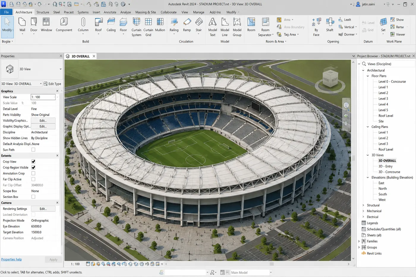
Comprehensive civil infrastructure BIM modeling for transportation, public utilities, roads, bridges, and site developments.
Civil site topography, hardscape/softscape 3D BIM modeling, site grading, retaining walls, and outdoor amenity spatial coordination.
Site models describe the finished ground — levels, grading, retaining walls, paving, planting and outdoor amenities. They connect the building to its surroundings and support level, drainage and quantity checks.
- Topography and grading models
- Hardscape and softscape layouts
- Retaining walls and amenities
3D civil road corridor modeling, alignment profiles, pavement layer modeling, junction grading, and traffic network BIM integration.
Road corridors are built from the alignment and profile, with pavement layers, junctions and grading modelled as 3D surfaces. This makes cut and fill, layer quantities and interfaces with utilities easy to review.
- Alignment and corridor models
- Pavement layers and junctions
- Roads linked with utilities
Public street lighting BIM modeling, luminaire pole placement, underground electrical cabling, and feeder pillar distribution paths.
Street lighting is modelled as a complete network — poles, luminaires, foundations, feeder pillars and buried cabling — so spacing, cable routes and crossings with other services can be checked in 3D.
- Pole and luminaire placement
- Buried cabling and ducts
- Feeder pillar layouts
Subsurface utility BIM modeling including stormwater networks, foul sewer mains, potable water distribution, and telecommunication trench conduits.
Stormwater, sewer, water and telecom networks are modelled with pipe sizes, levels and chambers. Seeing every buried service together helps avoid crossings and level conflicts before excavation begins.
- Storm, sewer and water networks
- Telecom ducts and chambers
- Utility clash checks
Time-based 4D BIM construction scheduling, visual sequence simulation, logistics planning, and progress tracking.
Linking Primavera P6 / MS Project schedules to 3D building BIM models for step-by-step construction sequencing, crane logistics, and delay analysis.
The construction programme is linked to the model, so every activity appears on screen in the order it will be built. Teams can review the build sequence, crane and logistics plans, and compare planned against actual progress.
- Schedule-linked 4D simulations
- Logistics and crane planning
- Planned vs actual progress
4D scheduling and earthwork sequencing simulations for civil roadworks, bridges, utility trenching, and site earthworks.
For roads, bridges and utilities, the 4D model shows earthworks, trenching and structures in sequence, helping to plan phasing, diversions and resources along the corridor.
- Earthworks and trenching sequences
- Phasing and diversion planning
- Progress against programme
Cost-integrated 5D BIM quantity take-offs (QTO), automated bill of quantities (BOQ), and real-time cash flow estimation.
Extracting accurate material quantities, concrete volumes, rebar tonnages, and MEP component counts directly from parametric 3D building models.
Quantities are taken straight from the model — concrete, rebar, finishes and MEP components — and organised into take-offs and bills of quantities. When the design changes, the quantities update with it.
- Model-based quantity take-offs
- BOQ-ready schedules
- Quantities that follow design changes
Civil quantity estimation for cut/fill earthworks, asphalt tonnage, utility piping line lengths, and infrastructure material costing.
Cut and fill volumes, pavement tonnages and pipe lengths are measured from the infrastructure model to support estimates, budgets and cash-flow planning.
- Cut and fill volumes
- Pavement and material quantities
- Utility line-length schedules
Photorealistic 3D architectural visualization, virtual reality (VR) walkthroughs, and marketing animations created from BIM models.
Immersive 3D video walkthroughs, exterior fly-throughs, and interactive 360-degree panoramic virtual tours of building and infrastructure BIM assets.
The BIM model is turned into photorealistic images, animated fly-throughs and 360° panoramas, so clients and stakeholders can understand the design clearly before it is built.
- Photorealistic renders
- Video walkthroughs
- 360° virtual tours
Automated BIM coordination reports, clash detection audits, LOD verification summaries, and periodic progress documentation.
Regular weekly and monthly BIM audit reporting, issue tracking dashboards, model compliance checks, and CDE data handover reports.
Regular reports keep the model healthy and the team informed: clash results, open issues, LOD checks and model compliance are tracked, and data is prepared for handover through the common data environment.
- Clash detection summaries
- Issue tracking dashboards
- Compliance and handover reports
CAD Documentation
Professional multidisciplinary 2D drafting, 3D CAD modeling, detailed shop drawings, and engineering documentation support across Building (Architecture, Structure, Interior, Mechanical, Electrical) and Infrastructure (Landscaping, Road, Street Light, Underground Utilities) domains.
Precision 2D/3D architectural CAD drafting, floor plans, building elevations, cross-sections, and detailed construction documentation complying with local authority standards.
Architectural drawings are prepared to the project's standards — plans, elevations, sections and details — ready for authority submission, tender and construction.
- Plans, elevations and sections
- Construction details
- Authority submission sets
Comprehensive structural CAD shop drawings including reinforced concrete detailing, structural steel framing, foundation layouts, and bar bending schedules (BBS).
Structural shop drawings show every member and reinforcement detail needed on site, from foundations to steel framing, together with the bar bending schedules used to cut and bend the steel.
- RC and steel shop drawings
- Foundation layouts
- Bar bending schedules
Detailed interior architectural fit-out CAD drawings, furniture layouts, reflected ceiling plans (RCP), wall elevations, and custom joinery detailing.
Fit-out drawings set out the interior for contractors and suppliers: furniture layouts, reflected ceiling plans, wall elevations and joinery details.
- Fit-out and furniture layouts
- Reflected ceiling plans
- Joinery and elevation details
HVAC ductwork layouts, chilled water piping schematics, ventilation plans, mechanical equipment schedules, and clash-free shop drawings.
Mechanical drawings cover ductwork, chilled water piping, ventilation and equipment schedules, coordinated with other trades so they can be installed without clashes.
- HVAC and ductwork layouts
- Chilled water schematics
- Equipment schedules
Electrical power distribution schematics, lighting layouts, low voltage (LV) systems, containment routing, cable tray paths, and single line diagrams (SLD).
Electrical drawings cover power distribution, lighting, low voltage systems and containment — from single line diagrams to cable tray routes.
- Single line diagrams
- Lighting and power layouts
- Containment and tray routes
Hardscape and softscape CAD layouts, site grading plans, irrigation network details, outdoor lighting paths, and urban amenity drafting.
Landscape drawings set out hardscape, softscape, site grading, irrigation and outdoor lighting for the whole site.
- Hardscape and softscape layouts
- Grading plans
- Irrigation details
Civil road alignment drafting, longitudinal profiles, cross-sections, pavement markings, traffic sign details, and junction CAD designs.
Road drawings include alignments, long profiles, cross-sections, pavement markings, signage and junction designs.
- Alignment and profile drawings
- Cross-sections
- Marking, signage and junctions
Public street lighting network plans, pole placement layouts, feeder pillar schematics, underground ducting, and photometrical CAD drawings.
Street lighting drawings show pole positions, feeder pillars, underground ducting and photometric layouts for the lighting network.
- Pole placement layouts
- Feeder pillar schematics
- Photometric drawings
Combined underground utility mapping (CUM), stormwater drainage, sewer networks, water supply lines, telecommunication ductways, and trench detail CAD drawings.
Utility drawings bring storm, sewer, water and telecom networks together, including combined utility mapping and trench and chamber details.
- Combined utility mapping
- Network layouts
- Trench and chamber details
3D Laser Scanning & Reality Capture
High-precision 3D laser scanning, terrestrial reality capture, and point cloud registration services for buildings, civil infrastructure, as-built documentation, recap modeling, and seamless Scan-to-BIM digital twin integration.
Comprehensive 3D laser scanning for commercial, residential, healthcare, and historic buildings. Captures millimeter-accurate spatial geometry, MEP installations, structural components, and complex facades to deliver precise as-built point cloud datasets.
Terrestrial scanners record the building as a dense point cloud — structure, façades and MEP installations exactly as they are today. It is a reliable starting point for renovation, verification and as-built modelling.
- Registered building point cloud
- Façade and MEP capture
- As-built survey data
Advanced 3D reality capture for major civil infrastructure including bridges, tunnels, highways, railway corridors, utility networks, and industrial plants. Ensures sub-centimeter accuracy for structural integrity assessment and expansion planning.
Bridges, tunnels, roads, rail corridors, utilities and plants are scanned to record their current geometry and condition, supporting inspections and future expansion design.
- Corridor and structure scans
- Geometry and condition records
- Data for expansion design
End-to-end point cloud registration, indexing, noise filtration, georeferencing, and Autodesk ReCap project compilation. Transforms raw mobile, terrestrial, and aerial scanner files into structured, unified coordinate project files ready for engineering design.
Raw scans are cleaned, registered and georeferenced into one project in Autodesk ReCap, so designers open a single, consistent point cloud instead of many separate scan files.
- Scan registration and alignment
- Cleaning and georeferencing
- Unified ReCap projects
Converting registered point cloud data into intelligent LOD 100 to LOD 400 Revit BIM models. Enables precise clash detection, facility renovation planning, MEP coordination, digital twin asset management, and verified as-built modeling.
The point cloud is converted into a Revit model at the required level of detail, giving a verified as-built model for design, coordination and asset management.
- As-built Revit models
- Scan vs design checks
- Models ready for digital twins
Sustainability Services
Green building facilitation, GSAS & LEED certifications, energy diagnostic audits, and carbon management strategies.
Helping projects achieve better environmental performance, regulatory compliance and internationally recognized sustainability objectives.
Energy Audit & Decarbonization
Comprehensive Energy Audit services providing detailed diagnostics, energy consumption analysis, ASHRAE Level 1, 2 & 3 audits, and cost-effective energy conservation measures across residential and commercial building assets.
Energy audits for residential developments, villas, high-rise apartments, and residential complexes focusing on HVAC optimization, lighting efficiency, thermal envelope insulation, and utility cost reduction.
Homes, villas and apartment buildings are reviewed to see where energy is used and lost — cooling, lighting and the building envelope — and practical savings measures are recommended.
- Energy use review
- HVAC and lighting measures
- Envelope and insulation improvements
Detailed energy diagnostics for commercial towers, corporate offices, shopping malls, hotels, and industrial facilities in accordance with ASHRAE audit standards to maximize operational energy efficiency.
Offices, malls, hotels and industrial facilities are audited to the ASHRAE audit levels, identifying savings in chillers, HVAC, lighting and power quality.
- ASHRAE Level 1, 2 & 3 audits
- Chiller and HVAC optimization
- Energy conservation measures
GSAS Consultancy
Professional GSAS sustainability consultancy supporting projects across design, construction and operational stages.
GSAS support during the design stage focuses on integrating sustainability requirements into project planning and design development. Our consultancy supports project teams in addressing GSAS criteria, sustainability strategies and documentation requirements from the early stages of design.
GSAS criteria are built into the project from the start: targets are set, strategies agreed with the design team, and the design-stage documentation prepared.
- GSAS target setting
- Design strategies and checks
- Design-stage documentation
During construction, GSAS consultancy supports project teams in implementing sustainability requirements and maintaining alignment with applicable project objectives and documentation through the construction process.
On site, practices and materials are tracked against GSAS requirements, and the evidence needed for the construction stage is collected and organised.
- Site compliance monitoring
- Material and evidence tracking
- Construction-stage documentation
At the operational stage, GSAS support focuses on maintaining sustainable building performance and supporting applicable operational requirements, documentation and sustainability objectives.
In operation, building performance is monitored and documented against GSAS operational requirements, helping the building stay sustainable over time.
- Performance monitoring
- Operational documentation
- Ongoing improvement
Environmental Consultancy
Comprehensive Environmental consultancy services specializing in environmental impact assessments, real-time noise monitoring, carbon footprint auditing, and sustainable decarbonization strategies.
Continuous environmental noise monitoring, acoustic modeling, baseline sound level measurement, and noise mitigation planning for construction sites, industrial facilities, and urban developments.
Noise levels are measured on and around the site, modelled and compared with the applicable limits, with mitigation planned where it is needed.
- Baseline noise measurement
- Continuous monitoring
- Mitigation planning
Strategic carbon management services including Scope 1, 2, and 3 greenhouse gas (GHG) accounting, organizational carbon footprint auditing, life cycle assessments (LCA), and net-zero decarbonization roadmaps.
Emissions are counted across Scopes 1, 2 and 3 using ISO 14064 and the GHG Protocol, giving an organisational carbon footprint and a roadmap to reduce it.
- Scope 1, 2 and 3 accounting
- Carbon footprint reports
- Decarbonization roadmaps
LEED Consultancy
Comprehensive LEED sustainability consultancy supporting green building projects across design, construction, and operational lifecycle stages to achieve USGBC certifications.
LEED support during the design stage focuses on integrating USGBC sustainability prerequisites and credits into early architectural planning, energy modeling, daylighting design, and sustainable material specifications.
Prerequisites and credits are planned early — energy modelling, daylighting and material choices — so the design stays on track for the target LEED rating.
- Credit planning
- Energy and daylight modelling
- Material specifications
During the construction phase, our LEED consultancy ensures strict compliance with construction activity pollution prevention, waste management diversion, indoor air quality management plans, and sustainable material tracking.
On site, pollution prevention, waste diversion, indoor air quality plans and material tracking are managed and documented for LEED.
- Pollution prevention
- Waste diversion tracking
- Indoor air quality plans
For operational assets, LEED O+M consultancy focuses on optimizing building energy performance, indoor environmental quality monitoring, water efficiency verification, and continuous performance benchmarking.
For existing buildings, LEED O+M work improves and verifies energy, water and indoor environmental performance, with continuous benchmarking.
- Energy and water performance
- Indoor environment monitoring
- Performance benchmarking
Digital Twin
Transformative Digital Twin solutions connecting spatial BIM models with real-time IoT monitoring and lifecycle asset management.
The tangible operational environment.
Structured spatial & technical information model.
Operational representation connecting physics with data.
Smarter lifecycle management and real-time visualization.
Integration and asset management
System Integration
Connecting heterogeneous building automation, BMS, CAFM, and ERP software with Digital Twin hubs.
- REST/GraphQL API Middleware
- BMS/BAS Integration
- CAFM & ERP Connector
- Data Pipelines
Asset Management
Comprehensive facility asset lifecycle tracking, maintenance scheduling, and digital operations handover.
- Maintenance Scheduling
- Work Order Automation
- Lifecycle Cost Analysis
- Asset Register Management
What a digital twin gives you
Unified and secure data across the asset lifecycle.
Live data insights for better situational awareness.
AI-driven predictions to minimize downtime.
Optimize performance and reduce operational costs.
Simulate scenarios for smarter decision making.
Detect, track and resolve issues efficiently.
Continuous assessment of asset health and risk.
Improve energy efficiency and sustainability.
Manage the asset lifecycle from design to decommission.
Digital Construction Technology
Connecting project teams, sites and technical specialists through digital technologies for improved collaboration, inspection and decision-making.
Capture the site, see the model on it
360° Site Documentation
High-resolution 360-degree photo and video documentation indexed to BIM drawings for visual tracking.
- 360° Site Photo Mapping
- Time-Lapse Progress Tracking
- BIM Overlay Comparison
- Historical Documentation
AR Solutions
Augmented reality visualization overlaying 3D BIM models directly onto job site physical spaces.
- BIM Overlay on Site
- Clash Detection in AR
- Remote Expert Assistance
- Safety Hazard Training
Work together, check remotely
Digital Collaboration
Cloud-based common data environments (CDE), real-time BIM collaboration, and digital project management.
- CDE Common Data Environment
- Real-Time BIM Cloud Sync
- Digital Workflow Automation
- Issue Management
Remote Inspection
Digital QA/QC inspection workflows reducing travel overhead while ensuring compliance.
- Live Video Site Walkthroughs
- Digital QA/QC Checklists
- Snag & Defect Tracking
- Remote Witness Inspections
Why Blue Crescent
- 01Guided by the best team leaders, supported by skilled staff, corporate commitment to deliver the services at their best quality while controlling the costs and time components.
- 02Solutions are provided in various options and supported with recommendations that best suit the Clients requirements.
- 03Services are applicable for Owners, Designers, Contractors and Operators.
- 01Established in Doha, Qatar to serve the Construction Sector.
- 02Envisioned to expand the current strength to meet the growing needs of Qatar and other regions.
- 03Equipped with most experienced staffs to deliver the Engineering Projects at various levels.
- 04Economical Solutions with greater Engineering Values.
- 05Specialized Engineering Support Services ranging from Concept development to Construction documentation.
- 06Experienced in Qatar Market with various Clients including Contractors & Consultants.